The Spanish pilot has reached another important milestone with the latest progress in the development of its Digital Twin for the Burgos area. Building on the ground-truth data collected during the pilot’s data-capture campaign, partners have recently analysed and processed the information to create a digital representation of the road that will support safer and more efficient road management.
Transforming data into actionable insights
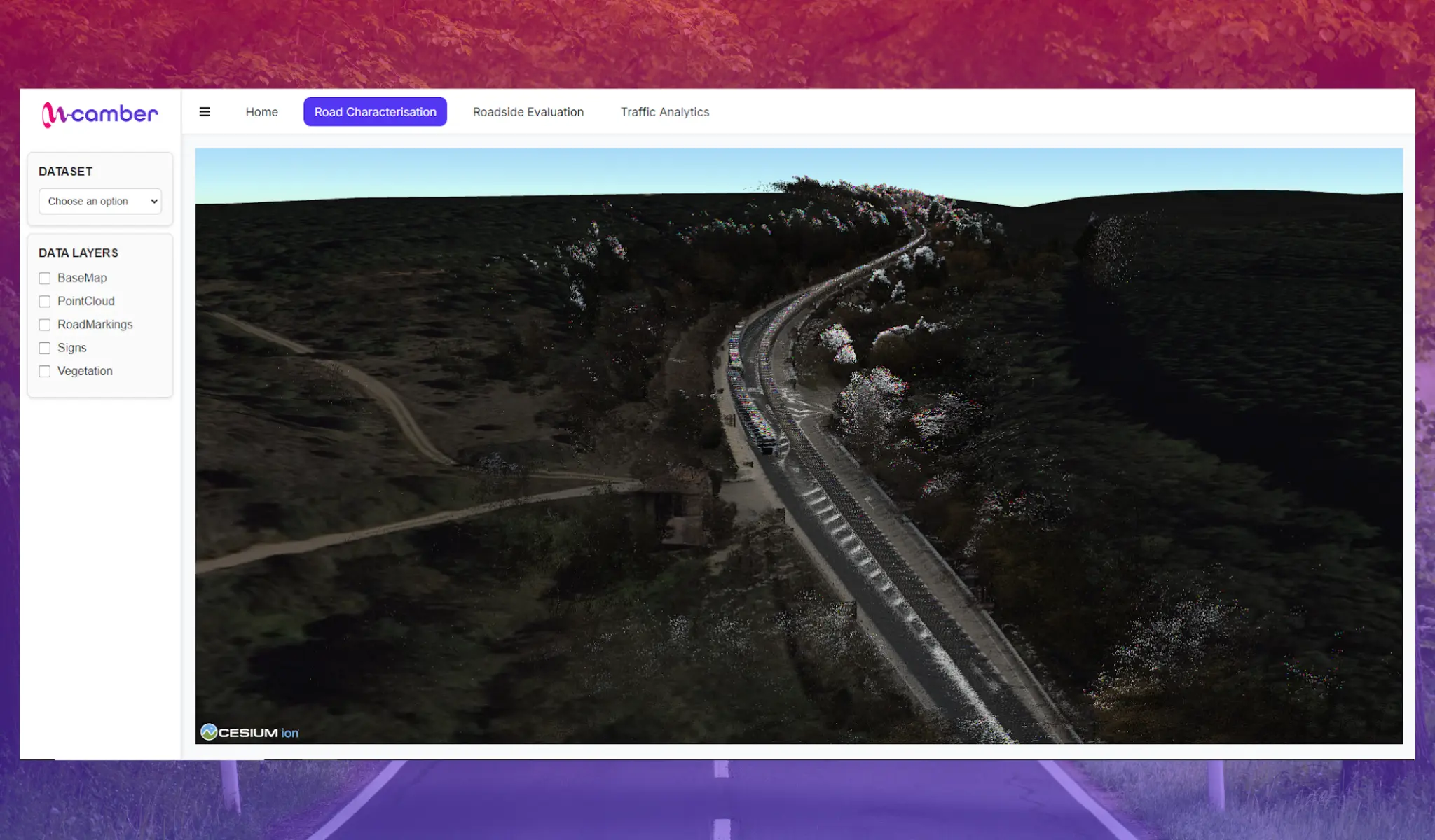
The Digital Twin is being developed to synthesise data from various sources into a single interactive platform, providing a comprehensive overview of the road environment. It has several key objectives: to support data-driven decision-making for traffic management, identify critical road safety hotspots, evaluate specific road conditions, and perform a digitalised information quality assessment while creating a new road inventory.
To achieve these objectives, dedicated components are being developed within the Digital Twin’s web interface, allowing users to visualise and analyse different types of infrastructure data in an intuitive way.
Exploring the road through the Digital Twin
One of the first features currently under development is the Road Characterisation section. This interactive component will enable users to explore the information collected, including georeferenced point clouds, extracted road markings, traffic signs, vegetation, and other road inventory data.
By providing a detailed digital representation of the road environment, the platform will support infrastructure assessment, improve information quality, and help road authorities better understand road conditions and prioritise safety interventions.
As development progresses, the Spanish pilot will continue demonstrating how Digital Twins can help transform road data into practical tools for safer, smarter and more resilient secondary road networks across Europe.